Island Images - The Isle of Man in Pictures
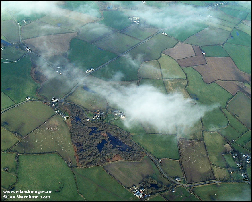
A closer look at the wetlands area, named as Lhaggag Mooar on current maps. On the 1870 Ordnance Survey map it's called Lagag Mooar and an old fort is shown within it, interestingly called 'The Buggane'
An
Island Images
picture ©
Jon Wornham